Friday, September 24, 2010

Shaken Not Stirred: Klondike 2010


Well, Shaken Not Stirred will be the first to tell you that we may not be the fastest team on the road to Whitehorse, but if there were a category for "The Most Fun Team," (and there should be) we'd be right up there with the guys running in the tight, red dresses. Here's our recap of Klondike 2010.

This is our team, fresh off the fast ferry, clean and wide-awake at the start in Skagway at 8:30 p.m. Yukon time. Look closely because it's the last time we'll appear well-rested.


The Klondike Relay is an annual event held every September. It's a relay run replicating the 1998 Klondike Gold Rush stampede from Skagway, Alaska, over White Pass in British Columbia and into the Canadian Yukon. Each team has 10 members, running a total of 175 km (108.7 miles). Our team is lucky: Shaken Not Stirred not only has 10 runners, but we also have our fearless, nocturnal driver, CAROL:


We know how critical Carol is to our team because one year Carol was AWOL...and so were we at a 2:00 a.m. hand-off point (which I still believe is more Michelle's fault than mine but that's another story). Carol also supplies Shaken Not Stirred with its blinkey martini glass lights, and this year, thanks to Doug, we strapped on full-fledged emergency flashers. It was great! We could see our cars flashing for miles throughout the night. Unfortunately, so could the border patrol.

Our team is also fortunate to have our captain, Sharon. One of Sharon's responsibilities is estimating our total running time (hence our individual running times). Sharon's mental gymnastics have accommodated our varied running styles as well as designating which leg each of us will attempt annually given our individual pursuits of running all 10 legs.


Sharon also makes sure our first runner remembers to check in with the Race Director, Buckwheat. This task was especially important this year because I was our first runner and it never occurred to me to check in.


So, I led our team off with the first leg out of Skagway and Kristen had the second. Between the two of us, in a little over 14 miles, we climbed 3293 feet to White Pass.


White Pass is gorgeous...when you can see it.


It was dark by the end of my leg and pouring during much of Kristen's, Sharon's and Colleen's legs. After we agreed to turn off our car-top emergency roving light, we breezed through Canadian Customs (and reconnected our beacon a mile later). The four of us in our car were all done around 2:30 a.m. and our 'women of the night', Denise, Mary, (with Carol driving) had the longest and darkest legs.


Mary wore my GPS watch, so I'm in control of her stats and am publishing them here for the world to see how speedy she is on the longest and latest leg of the Klondike: Mary Schlosser's Klondike Run by anne.johnson1 at Garmin Connect - Details After you've memorized Mary's stats, you can click on the "Satellite" map and view her leg in Google Earth.

Legs 5 and 6 run along Tutshi Lake and the hand off is on the border between British Columbia and the Yukon. It's a beautiful drive...again during the day or maybe anytime on June 21st.


Suddenly (after a few hours of sleep in Whitehorse), it was broad-daylight on Saturday. The rain from the night subsided. Jana ran leg 7 up to Emerald Lake.


Michelle followed with Leg 8. Our car arrived for Kari's finish on Leg 9.


Jeanine finished it off for Shaken Not Stirred in the mid-afternoon.


Aaahhhh...another successful Klondike. And, the best part of the weekend was still ahead.


Hey, why wear those running skorts running when you can wear them drinking?


We toasted Kristen for completing her 10th leg. The next day, half of the group turned to the greens while others biked or hiked.


For anyone interested in registering for the 2011 Klondike, here's the website: http://www.klondikeroadrelay.com/race2/?page=dates


Here's the elevation chart for all ten legs: Klondike elevation chart: http://www.klondikeroadrelay.com/race2/krrmap.pdf


Here are the leg 1 stats: Klondike Leg 1 by anne.johnson1 at Garmin Connect - Details

Run responsibly. Cheers!

Juneau Ridge Run - Sunny September

We just had the most fantastic stretch of dry, crisp autumn weather here in Juneau. Eleven days of sunshine and warm weather carried us right through the fall equinox. And, what better way to spend a sunny Saturday in September than running the Juneau Ridge?


Kari had never been up on the ridge. Having just run it a few weeks ago with Sharon in the clouds, I was eager to run it with the sunshine on my back and analyze the location where Sharon and I had gotten lost (see August 27, Running the Ridge in the Clouds).


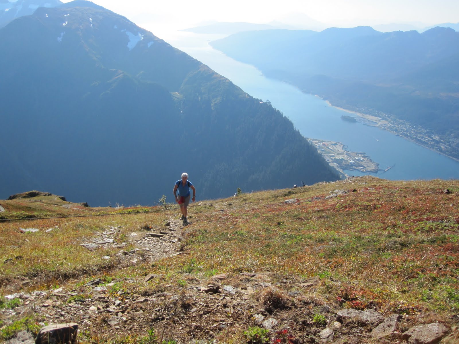
In just four short weeks, I had forgotten how steep the first 3 miles is up to the ridge. It's too steep to run, but we hiked at a steady pace with the Gastineau Channel below and were on top in an hour and a half.


The climb from our Subaru to the ridge was close to 3000 feet. According to my Garmin watch, the elevation was 3550 feet at the start of the actual ridge run. We stopped for a power bar, marveled at the 360 degree view, and were quickly off again.


Hhhmmm...maybe I need to work on my running form. It looks like I'm dancing through the lichen and rocks. We're definitely above tree line. Despite the open views, we didn't see any bears or mountain goats. Just a few hikers above us on the trail.


Below is the area where Sharon and I veered to the right in the white-out. It's amazing how much easier it is to stay on the trail when you can see further than 100 feet ahead!


There's still a bit of snow but it's pretty much gone on the top. All of that could change in the next month.


After 3.5 miles on the ridge, we headed down into Granite Basin. It's a rocky mile or so.


Granite Basin has changed in the last several weeks. The lichen has turned red, the Salmon and blue berries are gone, and the brush has retreated.


Granite Basin was full of hikers, climbers and dogs. We stopped to visit with friends several times but still made it back to Perseverance Trail and down to our car in 4:45 minutes.


A beer on the wharf was the perfect ending, and only Kari can run 13 miles through the mountains, gain 5,000 feet of total elevation, and still look spotless at the end!

Here are the Garmin stats, including the elevation chart and satellite view of the trail (reminding me that we live on the edge of vast ice-fields).
Running the Ridge in the Sunshine by anne.johnson1 at Garmin Connect - Details

The rain is back and the nights are coming early. Take care, AJ

Updated photos below: Ridge run with Ed June 2013

Ed enjoys the Juneau scenery

June 2013 - sunshine!

We stopped for 30 minutes and soaked in the warm pool!
Our run time was 4 hours and our total time, including 30 minutes of bathing, was 4:30.  Lots of snow still on top.

Monday, August 30, 2010

Windfall to Montana Creek: Brown Bear Country

Four women start up a remote, muddy 14 mile trail through the mountains of Alaska in the late afternoon, with no cell phone coverage, no map, no compass, no supplies other than pockets full of jelly beans, and one diminutive can of bear spray that expired in 2006...sound like fodder for the next reality show? Maybe. Except that all four of us survived running Windfall Trail to Montana Creek, plus an additional three miles to Skater's Cabin, and our only disfigurements were blueberry stained fingers and scratches caused by the massive Devil's Club.

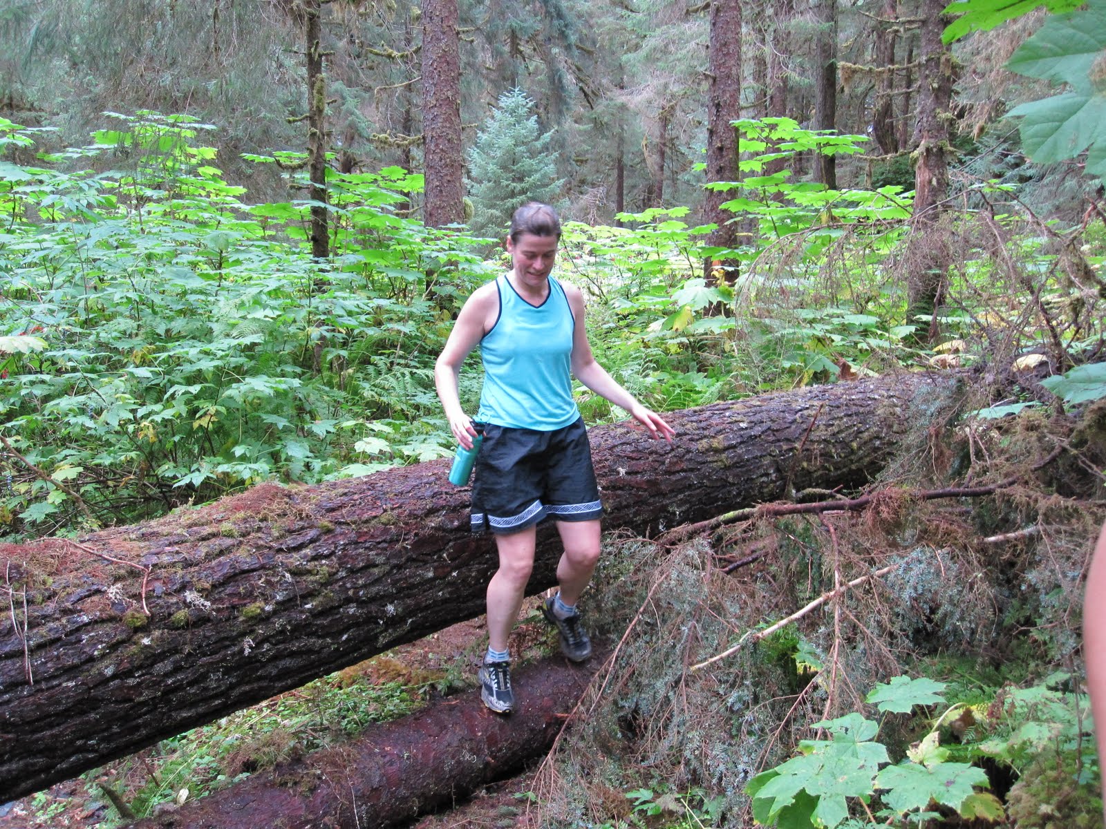
Windfall Trail begins roughly 26 miles north of Juneau near the outflow from Herbert Glacier. There are literally miles of planks to run and old, moldy corduroy logs to skitter across and countless streams to jump over (or stumble through). It's downright nasty, and never mind the fact that this is brown bear country.
So, why did we decide to run this long, potentially treacherous route? Because the annual Klondike Relay is fast-approaching and we need some serious mileage. Other than Treadwell Ditch, Windfall Trail to Montana Creek is one of the few trails in Juneau that is runnable, well - runnable by Juneau standards, and covers many miles without forcing you to climb 3000 feet into the clouds right off the bat (for that, see Friday's report of Running the Juneau Ridge). In fact, Treadwell only climbs 890 feet total, to mile 7.5, and there you are treated to a gradual descent of several miles through a stunning alpine meadow. But, believe me, as Michelle and Denise demonstrate, you pay for the gradual climb in other ways!

Windfall Trail starts out mild and is deceptively well-maintained for the first couple of miles, luring you like Hansel and Gretel into the verdant forest where you cross the gorgeous, glacier-fed Herbert River twice on relatively new and stable wooden bridges. After three and a half delightful miles, tranquil Windfall Lake comes into view on the right (West). It's lovely, and for a moment I think I'm back at my cabin in northern Minnesota. Feeling fresh, the four of us fully enjoyed this section of the trek and stopped to eat blueberries and peer at a couple of float planes and fly fisherman on the far side of the lake. After the cabin turn-off, the route quickly turns technical with several large, downed trees and soggy (slippery) planking that stair-steps its way up through the dense forest. The Devil's Club and Skunk Cabbage are suddenly enormous. And, the mud...where did all the mud come from? We haven't had a hard rain in Juneau in days. Predictably, our pace slowed between miles four and seven as we squished and slid our way through the forest. The highpoint was stopping to eat Mary's scrumptious peanut butter jelly beans and luckily she had an entire pack along, so there would be more for later. And, there were hundreds of chunky blueberries that we snatched and munched along the way. As I've just learned from the Internet, one serving of blueberries contains 25% of a daily dose of Vitamin C. They're also high in fiber and are an excellent source of manganese (good for your bones and metabolizing protein, carbs and fat) and, more than any other food, blueberries contain antioxidants that help neutralize free radicals which are unstable molecules linked to cancer, cardiovascular disease and other age related conditions. If I had known Sunday that blueberries are practically magical, I would have spent our 3.5 hours running time, loading my Camelbak full of them. Anyway, I digress.

Probably the most exciting part of the run started about a mile before we reached the alpine meadow. We were comfortably trotting through the tall trees when we came upon several large, fresh brown bear prints. Not just one print mind you, but many, and they ranged along three to four miles of the trail; all heading in the opposite direction from us. Hhhhmmm..huge, fresh tracks coming straight at us. Do you think the Grizzly heard us approaching and stepped off the trail a short ways back while we unwittingly passed within inches of it, stuffing our mouths with blueberries? Yep, probably. When we reached the meadow, the planking was no longer slimey green but dry, gray wood, and it's surprising how good that made me feel. We were no longer bushwacking through berry bushes and Devil's Club but were treated to lovely views of misty peaks. The trail trended down now for the remaining eight miles. After two more miles we could hear the flowing waters of Montana Creek and soon we could see it. The Montana Creek Trail began to hug the creek and was measurably better than the Windfall portion, except for three sections of gritty, black sand, abutting the creek about 40 feet above it. Don't look down! Generally though, you can open up and really run Montana Creek. We picked up our pace and after a couple of miles sprinting down the hard-packed trail, we crossed a large wooden bridge where the trail turns into a dirt road, and a short time later, we were at the trailhead. Our bear fears evaporated, and naturally we were all pretty hungry at this point. Good thing Mary had those peanut butter jelly beans along for us to share because we still had three miles of pavement, past the shooting range to Mendenhall Glacier and our big finish. It was 6:00 p.m. when we touched Skater's Cabin. Windfall Trail to Montana Creek may not include any dramatic climbs, but it's an arduous trek nevertheless, and we did it. How did we celebrate? We slowly pulled ourselves into Denise's car and split a bottle of lemon-lime Gatoraid. If this had been a reality show, we would've been ousted for such an anti-climatic ending, and the producers would have substituted four bikini-clad babes, perched atop the ice-berg near Skater's Cabin and the final scene would've shown them floating off into the sunset ready for their next adventure.Such is life.

Running Stats: time 3:30; distance 14.5 miles; Pace 14:30 min/mile; Calories burned 1522; highest elevation 890 feet.


Klick here to view the Garmin stats and Google map. Untitled by anne.johnson1 at Garmin Connect - Details: "Share". See you at Klondike!