 Four women start up a remote, muddy 14 mile trail through the mountains of Alaska in the late afternoon, with no cell phone coverage, no map, no compass, no supplies other than pockets full of jelly beans, and one diminutive can of bear spray that expired in 2006...sound like fodder for the next reality show? Maybe. Except that all four of us survived running Windfall Trail to Montana Creek, plus an additional three miles to Skater's Cabin, and our only disfigurements were blueberry stained fingers and scratches caused by the massive Devil's Club.
 Windfall Trail begins roughly 26 miles north of Juneau near the outflow from Herbert Glacier. There are literally miles of planks to run and old, moldy corduroy logs to skitter across and countless streams to jump over (or stumble through). It's downright nasty, and never mind the fact that this is brown bear country.

 So, why did we decide to run this long, potentially treacherous route? Because the annual Klondike Relay is fast-approaching and we need some serious mileage. Other than Treadwell Ditch, Windfall Trail to Montana Creek is one of the few trails in Juneau that is runnable, well - runnable by Juneau standards, and covers many miles without forcing you to climb 3000 feet into the clouds right off the bat (for that, see Friday's report of Running the Juneau Ridge). In fact, Treadwell only climbs 890 feet total, to mile 7.5, and there you are treated to a gradual descent of several miles through a stunning alpine meadow. But, believe me, as Michelle and Denise demonstrate, you pay for the gradual climb in other ways!
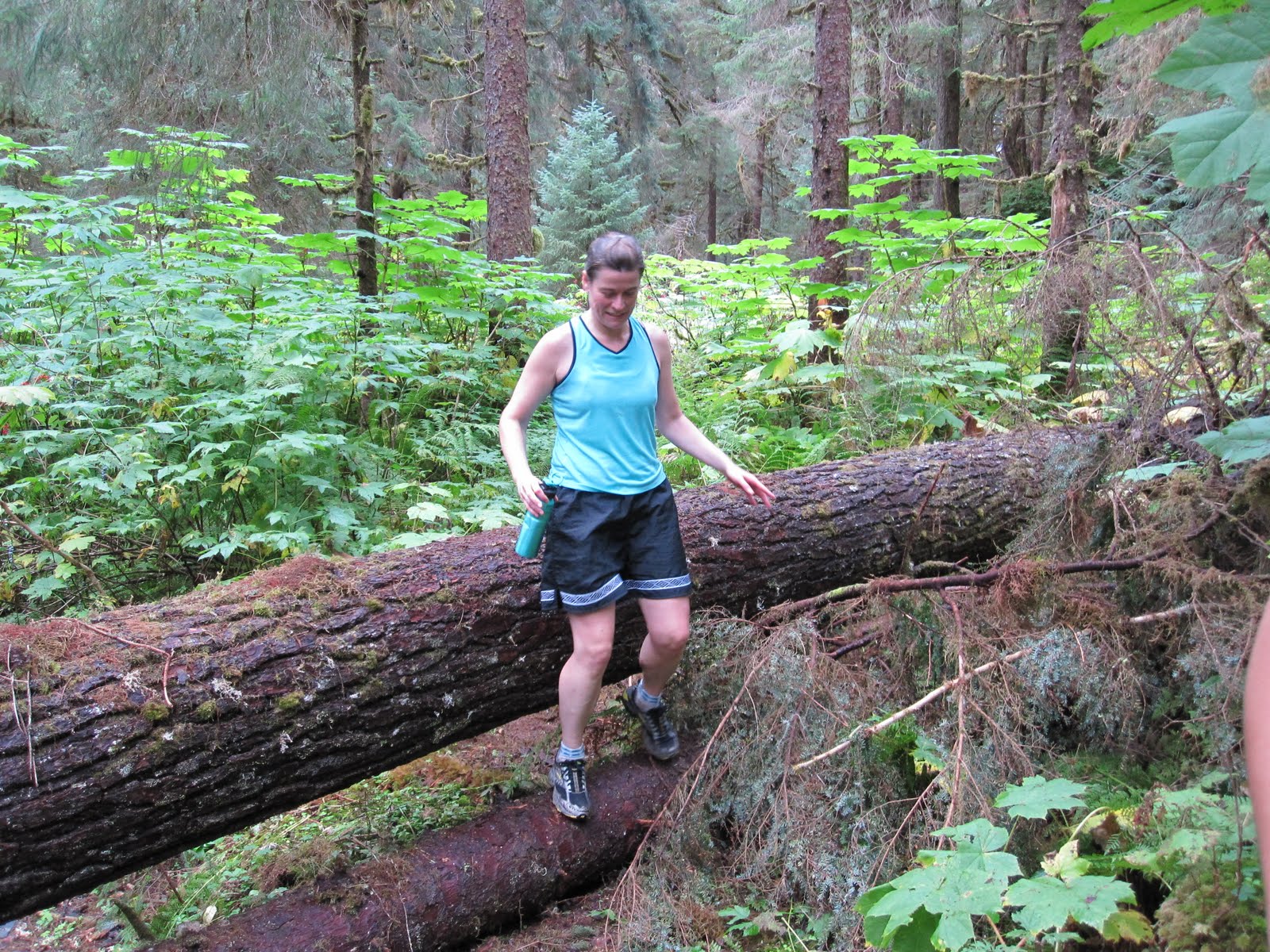

Windfall Trail starts out mild and is deceptively well-maintained for the first couple of miles, luring you like Hansel and Gretel into the verdant forest where you cross the gorgeous, glacier-fed Herbert River twice on relatively new and stable wooden bridges. After three and a half delightful miles, tranquil Windfall Lake comes into view on the right (West). It's lovely, and for a moment I think I'm back at my cabin in northern Minnesota. Feeling fresh, the four of us fully enjoyed this section of the trek and stopped to eat blueberries and peer at a couple of float planes and fly fisherman on the far side of the lake.
 After the cabin turn-off, the route quickly turns technical with several large, downed trees and soggy (slippery) planking that stair-steps its way up through the dense forest. The Devil's Club and Skunk Cabbage are suddenly enormous. And, the mud...where did all the mud come from? We haven't had a hard rain in Juneau in days.
 Predictably, our pace slowed between miles four and seven as we squished and slid our way through the forest. The highpoint was stopping to eat Mary's scrumptious peanut butter jelly beans and luckily she had an entire pack along, so there would be more for later. And, there were hundreds of chunky blueberries that we snatched and munched along the way. As I've just learned from the Internet, one serving of blueberries contains 25% of a daily dose of Vitamin C. They're also high in fiber and are an excellent source of manganese (good for your bones and metabolizing protein, carbs and fat) and, more than any other food, blueberries contain antioxidants that help neutralize free radicals which are unstable molecules linked to cancer, cardiovascular disease and other age related conditions.
 If I had known Sunday that blueberries are practically magical, I would have spent our 3.5 hours running time, loading my Camelbak full of them. Anyway, I digress.
Probably the most exciting part of the run started about a mile before we reached the alpine meadow. We were comfortably trotting through the tall trees when we came upon several large, fresh brown bear prints. Not just one print mind you, but many, and they ranged along three to four miles of the trail; all heading in the opposite direction from us. Hhhhmmm..huge, fresh tracks coming straight at us. Do you think the Grizzly heard us approaching and stepped off the trail a short ways back while we unwittingly passed within inches of it, stuffing our mouths with blueberries? Yep, probably.
 When we reached the meadow, the planking was no longer slimey green but dry, gray wood, and it's surprising how good that made me feel. We were no longer bushwacking through berry bushes and Devil's Club but were treated to lovely views of misty peaks. The trail trended down now for the remaining eight miles.
  After two more miles we could hear the flowing waters of Montana Creek and soon we could see it. The Montana Creek Trail began to hug the creek and was measurably better than the Windfall portion, except for three sections of gritty, black sand, abutting the creek about 40 feet above it. Don't look down!
  Generally though, you can open up and really run Montana Creek. We picked up our pace and after a couple of miles sprinting down the hard-packed trail, we crossed a large wooden bridge where the trail turns into a dirt road, and a short time later, we were at the trailhead. Our bear fears evaporated, and naturally we were all pretty hungry at this point.
  Good thing Mary had those peanut butter jelly beans along for us to share because we still had three miles of pavement, past the shooting range to Mendenhall Glacier and our big finish. It was 6:00 p.m. when we touched Skater's Cabin.
  Windfall Trail to Montana Creek may not include any dramatic climbs, but it's an arduous trek nevertheless, and we did it. How did we celebrate? We slowly pulled ourselves into Denise's car and split a bottle of lemon-lime Gatoraid. If this had been a reality show, we would've been ousted for such an anti-climatic ending, and the producers would have substituted four bikini-clad babes, perched atop the ice-berg near Skater's Cabin and the final scene would've shown them floating off into the sunset ready for their next adventure.
 Such is life.
Running Stats: time 3:30; distance 14.5 miles; Pace 14:30 min/mile; Calories burned 1522; highest elevation 890 feet.

Klick here to view the Garmin stats and Google map. Untitled by anne.johnson1 at Garmin Connect - Details: "Share". See you at Klondike!


