It's been raining sideways for three weeks straight and dark by late afternoon. I'm babying a knee injury and hoping to heal up by the start of the ski season. Feeling restless, I decided to try something different and registered for a ten day Backcountry Navigation course at the local college, the University of Alaska Southeast. It was an advanced level course with the school's distinguished Outdoor Studies Program.
 After spending one weekend navigating on local trails and five nights of course work, I adjusted my compass for the magnetic declination of 21.5 degrees east of the geographic north pole and, along with ten other students, set out on a three day backcountry trip. During the week leading up to our trip, Juneau was close to breaking a local rain record (and in the Tongass Rainforest that's nothing to scoff at). It's hurricane season and the winds whipped up to 50 miles per hour. Locals were wearing Gore-Tex rain pants to work, our driveway flooded, and our dogs refused to leave the house.
Given the weather, a third of my class dropped out before our departure day, and to be honest I was dreading the experience. Our instructors were two Alaska mountain men who thought nothing of dead-heading on a seasons-end helicopter run to Teslin and skiing back 50 miles atop the glacier. I know this because instead of sticking to our course work the night before the trip, they showed us pictures of themselves a month earlier crossing icy crevasses and free-climbing slick rock ravines. The Mountain Men told us we would navigate only by map and compass through the water-sogged backcountry and rumor was we would get an "F" if we skirted an established trail or were caught bailing ourselves out with a GPS.

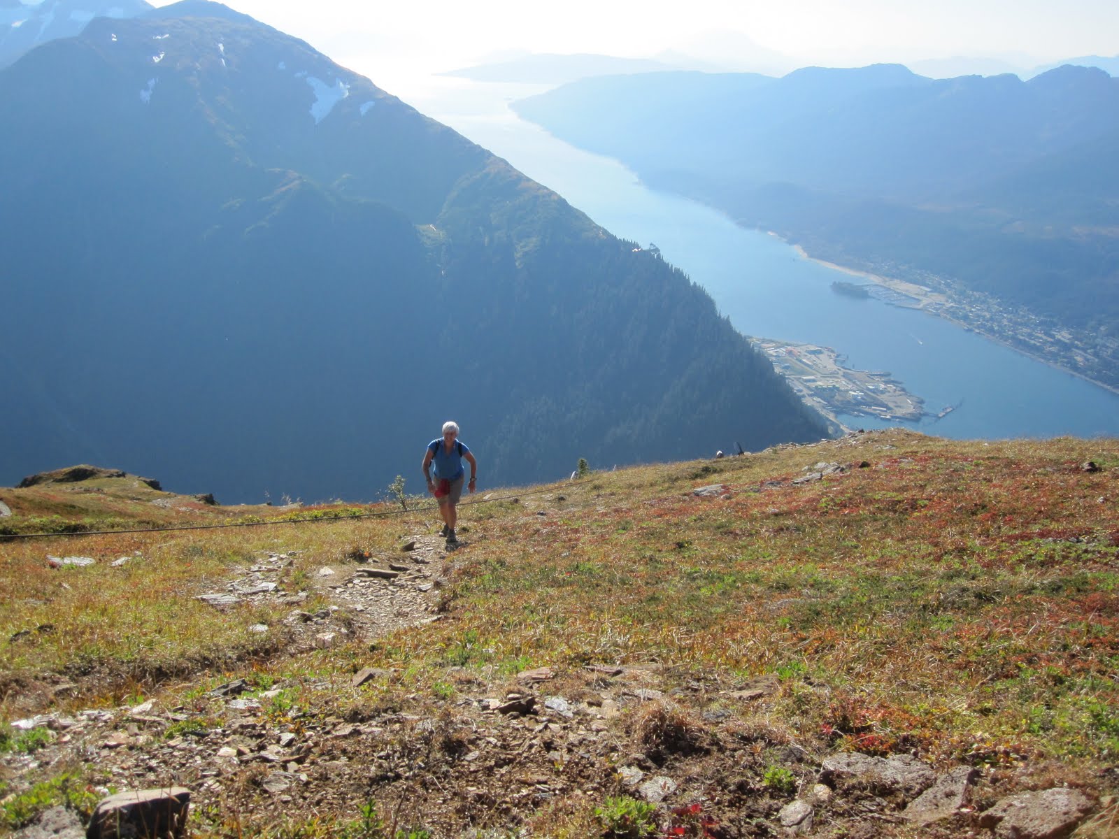
Needless to say, I didn't sleep well on Thursday night before our departure. Friday morning, in a light rain, a University van dumped us off 'out the road'. Our group headed east, straight into the dripping woods and upwards along a rushing stream with a goal of ascending 1200 feet and contouring along a narrow ridgeline S by SE (that's navigator talk).
The verdant summer foliage was gone but the alder and berry bushes remained and we tried to navigate upwards through dense thickets of underbrush. Within thirty minutes, everyone had fallen at least once along with their 40 pound packs and we were muddy and wet. Our instructors slithered gracefully above us through the forest, looking slightly amused and slightly disgusted by our performance.
 After several hours of trudging upwards and getting whacked repeatedly by Devil's Club and alder, we tripped and slopped our way onto a narrow muskeg with a steep slate wall to our east and a drop-off 200 yards to our west.
  It was barely 5:00 in the evening but already dark. I love to try new things and should've been excited about the opportunity to sleep in a swamp (at least that's what I told myself).
But no one looked exactly thrilled as we staked our tents in three inches of spongy water. Dinner Friday night was rather quiet but for the steady drumming of rain on our cook tent. I tried not to fall into the bog-hole where we pumped our water and snuggled into my soggy tent at 7:00 p.m. for twelve (yes, twelve!) hours of mandatory "shut-eye" before sunlight.
 My assigned tent-mate was a gorgeous, 20 something Hispanic man from Texas who had recently climbed Denali with UAS's outdoor study program. I climbed in next to him on my squeaky REI camp mattress thinking what a lovely opportunity this would be if I were straight and 25 years younger. Such is life.
The next morning after I ate two packets of my oatmeal and choked down two cups of coffee in a canteen still tasting of yesterday's mango tea, we packed up and headed south. I quickly came to love traveling through muskegs. Despite the chilly water sloshing around inside of my $200 Gore-Tex (ie. waterproof) Montrail hiking boots, I found there is very little Devil's Club and alder in a muskeg. We moved faster, and I was hoping the tiny, bloody scars on my face from Friday's climb through the brush might begin to heal. We all felt relieved and goofed around with Goat's Beard until the Mountain Men reminded us that we were already basically a day behind our schedule.

Around lunchtime (the Mountain Men wouldn't actually let us stop to eat lunch but my watch said 12:15), we descended towards a lake and then quickly climbed towards a pass north of Inspiration Point.
 There was only a small amount of snow at the pass. We headed down and turned northwards towards Peterson Lake.
On the trip, it was mandatory that we all lead the group and act as back-up to the leader at least once. Because I've traversed from John Muir Cabin to Peterson Lake Cabin twice on skis, I volunteered to be the leader for this section.
 However, given the the Mountain Mens' rumored proclivity to downgrade, I didn't dare tell them that I was somewhat familiar with the area lest they considered that cheating. I took a bearing of eight degrees north, leading the group along animal tracks which unlike human-made tracks were totally copacetic and woods-savvy with the Mountain Men. We made good time and were soon traipsing along with Peterson Lake to our left. The woods were surprisingly lush.
  However, summer's broad-leafed Skunk Cabbage did not fare as well as the moss and lichen and were reduced to white, star-shaped shells.
 Thinking about the colors, my mind started to wander. One of the mountain men called a halt and questioned my bearing and asked for my conclusions about the "physiography of this V-shaped valley." I stared at my map, clueless. He offered that we had been descending generally through "U shaped valleys" and raised his eyebrows as though he had given me a tremendous factoid about the topography. Peering back at him through the rain, I was tempted to lie and say I was dyslexic and couldn't distinguish "v's" from "u's" and maybe it was time to call in the Mountain Rescue helicopter for me. Fortunately, two drenched students starting screwing around and Mountain Man had to get things under control.
  Then he addressed the entire group and patiently explained that the V-shaped valley indicated we were now in a ravine as opposed to the U-shaped glacier trough we had just descended and apparently this should all have been crystal clear to us from our map. Time for a new student leader.
  I switched to back-up leader behind a quiet student from Japan. We crossed an abandoned mining-car track, and after a few hours of descending through more spongy, green detritus, we camped in a different soggy muskeg.
 Around this time, my very expensive, dwarf camera froze up and refused to focus.
Sunday was much the same as Friday and Saturday. We trudged through thick brush and climbed up to a ridge where one of the students announced that he had twisted his back and couldn't travel much further.
 While we rested and glanced thankfully towards the injured student, the Mountain Men conferred and then capitulated and allowed us to traverse an old logging road towards the highway. We were out of the woods by 3:00 p.m. I was in my bathtub with a glass of straight Scotch by 4:00 p.m. By 5:00 p.m. I had forgotten all of the standard features of my Suunto compass...goodbye magnetic needle, meridian lines, two-degree graduation markers on a transparent rotating dial. Goodbye.