Well, Shaken Not Stirred will be the first to tell you that we may not be the fastest team on the road to Whitehorse, but if there were a category for "The Most Fun Team," (and there should be) we'd be right up there with the guys running in the tight, red dresses. Here's our recap of Klondike 2010.
This is our team, fresh off the fast ferry, clean and wide-awake at the start in Skagway at 8:30 p.m. Yukon time. Look closely because it's the last time we'll appear well-rested.

The Klondike Relay is an annual event held every September. It's a relay run replicating the 1998 Klondike Gold Rush stampede from Skagway, Alaska, over White Pass in British Columbia and into the Canadian Yukon. Each team has 10 members, running a total of 175 km (108.7 miles). Our team is lucky: Shaken Not Stirred not only has 10 runners, but we also have our fearless, nocturnal driver, CAROL:

We know how critical Carol is to our team because one year Carol was AWOL...and so were we at a 2:00 a.m. hand-off point (which I still believe is more Michelle's fault than mine but that's another story). Carol also supplies Shaken Not Stirred with its blinkey martini glass lights, and this year, thanks to Doug, we strapped on full-fledged emergency flashers. It was great! We could see our cars flashing for miles throughout the night. Unfortunately, so could the border patrol.
Our team is also fortunate to have our captain, Sharon. One of Sharon's responsibilities is estimating our total running time (hence our individual running times). Sharon's mental gymnastics have accommodated our varied running styles as well as designating which leg each of us will attempt annually given our individual pursuits of running all 10 legs.

Sharon also makes sure our first runner remembers to check in with the Race Director, Buckwheat. This task was especially important this year because I was our first runner and it never occurred to me to check in.

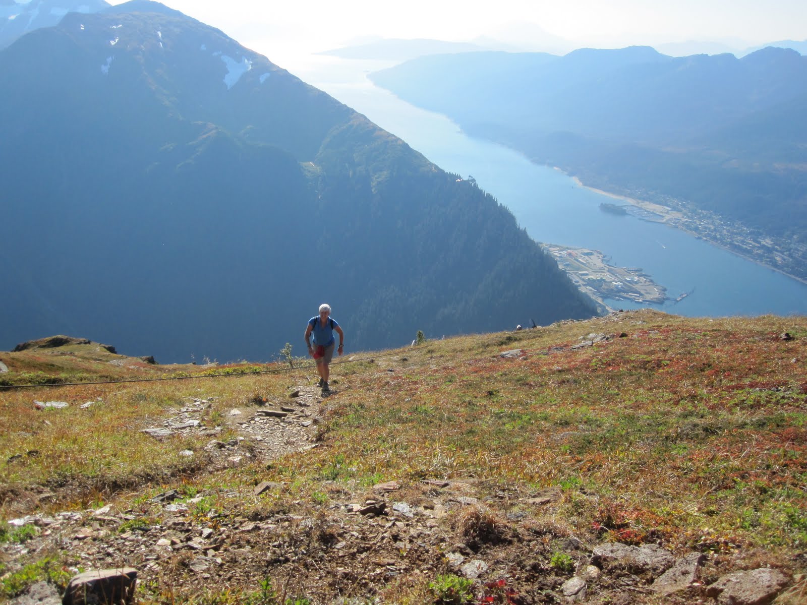
So, I led our team off with the first leg out of Skagway and Kristen had the second. Between the two of us, in a little over 14 miles, we climbed 3293 feet to White Pass.


White Pass is gorgeous...when you can see it.

It was dark by the end of my leg and pouring during much of Kristen's, Sharon's and Colleen's legs. After we agreed to turn off our car-top emergency roving light, we breezed through Canadian Customs (and reconnected our beacon a mile later). The four of us in our car were all done around 2:30 a.m. and our 'women of the night', Denise, Mary, (with Carol driving) had the longest and darkest legs.

Mary wore my GPS watch, so I'm in control of her stats and am publishing them here for the world to see how speedy she is on the longest and latest leg of the Klondike: Mary Schlosser's Klondike Run by anne.johnson1 at Garmin Connect - Details After you've memorized Mary's stats, you can click on the "Satellite" map and view her leg in Google Earth.
Legs 5 and 6 run along Tutshi Lake and the hand off is on the border between British Columbia and the Yukon. It's a beautiful drive...again during the day or maybe anytime on June 21st.


Suddenly (after a few hours of sleep in Whitehorse), it was broad-daylight on Saturday. The rain from the night subsided. Jana ran leg 7 up to Emerald Lake.

Michelle followed with Leg 8. Our car arrived for Kari's finish on Leg 9.


Jeanine finished it off for Shaken Not Stirred in the mid-afternoon.

Aaahhhh...another successful Klondike. And, the best part of the weekend was still ahead.

Hey, why wear those running skorts running when you can wear them drinking?

We toasted Kristen for completing her 10th leg. The next day, half of the group turned to the greens while others biked or hiked.


For anyone interested in registering for the 2011 Klondike, here's the website: http://www.klondikeroadrelay.com/race2/?page=dates

Here's the elevation chart for all ten legs: Klondike elevation chart: http://www.klondikeroadrelay.com/race2/krrmap.pdf

Here are the leg 1 stats: Klondike Leg 1 by anne.johnson1 at Garmin Connect - Details
 Run responsibly. Cheers!