The residents of Juneau are kinetic folk and many love to hike. But, I hadn't heard of anyone venturing around the backside of Douglas. I asked around and finally got in touch with a young guy who had hiked it with his buddy last summer. We spoke briefly on the phone and he told me it was "grueling". He said he started at 5:00 a.m. and finished at 10:00 p.m. He warned me that I'd be wet all day and should stay on the shore as much as possible despite all the rocks. He concluded by telling me he would never hike it again. Not exactly the endorsement I was hoping for...but it was a rare, hot and cloudless day in southeast Alaska, and Sharon and I were off.


Soon the beach was again strewn with rocks and covered with barnacles and Blue Mussels. Then the rocks grew larger, and then again, even larger. After about thirty minutes we were no longer hiking but climbing through several rocky outcroppings. After an hour of balancing on jagged, igneous rock, I sort of wished I were back sprawled in the sun on the lawn at Lucky Me listening to the Grateful Dead and smoking...no, never mind.

I'll admit that the next several hours were my least favorite part of our hike. We climbed our way around fifteen or so outcroppings covered with sharp-edged shells. My knee started bleeding after I simply rested up against one of the mussel-laden walls. I hadn't anticipated climbing as much as we did and our options were dwindling as the tide came in. The outcroppings separated the numerous tiny bays between Marmion Island and Point Hilda (a distance of approximately 11 miles).

As the tide came in, we were unable to maneuver our way around a few of the rocky barriers between the bays and we scrambled up into the woods and followed animal trails. By noon we could see Point Hilda 8 miles ahead with myriad, tiny, rocky bays tucked in between.

Around noon it hit me how far we had to hike and how long it would likely take us. Generally there was one waterfall per bay and if we couldn't easily cross through, we climbed up and around the falls through the woods. I enjoyed hiking in the cool woods on the spongey, moist forest floor. Needless to say our feet were continuously wet despite the warm weather.

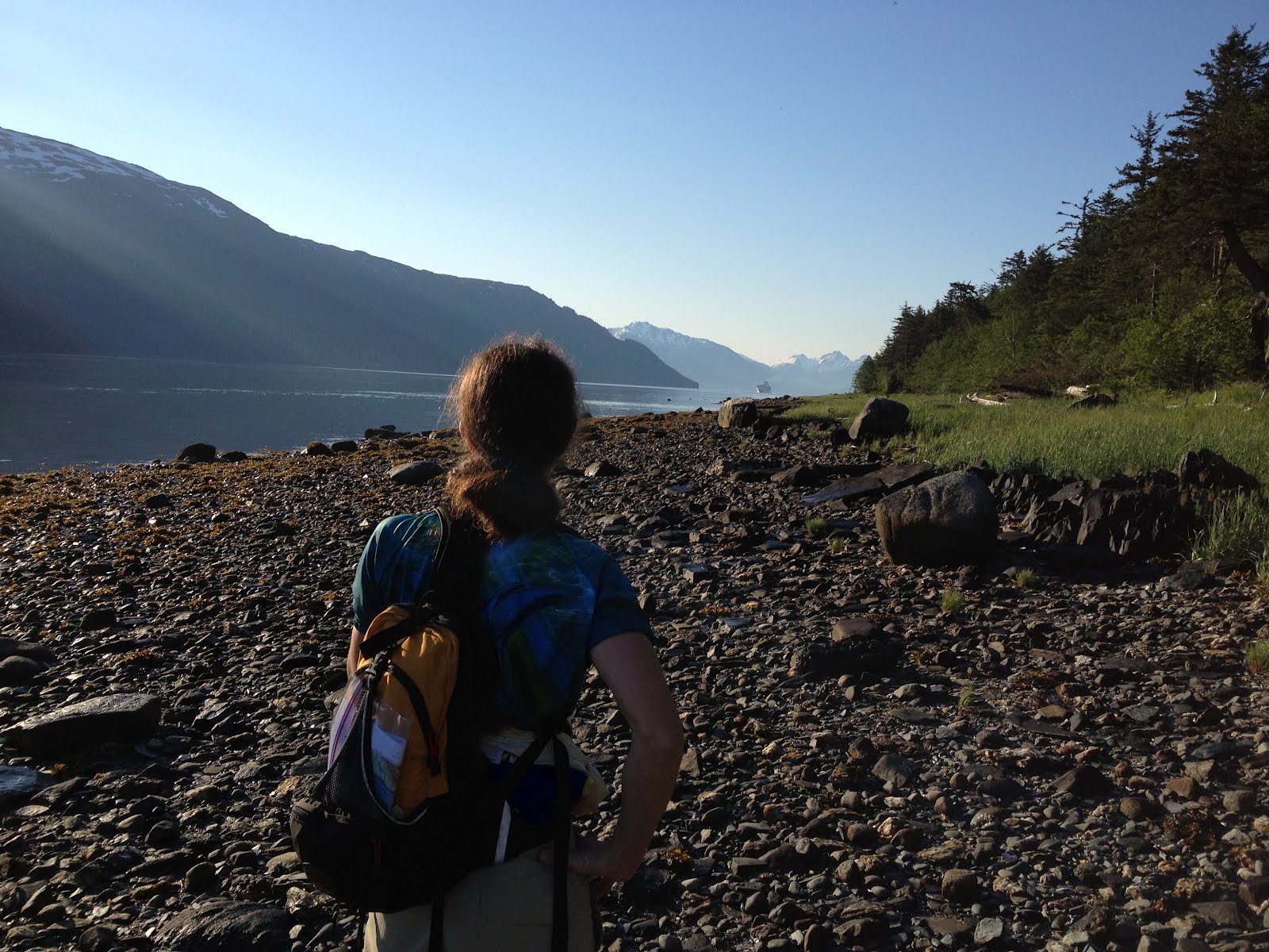
After a few more hours of patiently climbing over and around rocks or up into the woods as we did in the picture on the right, we were finally within a couple of miles of Point Hilda.
Here the beach suddenly turned sandy. It was incredible how sweet it was to stroll along the beach and simultaneously peer out at the water without risking a sprained ankle. We learned later that the temperature reached 82 degrees. That's a heat wave in Juneau given that the average temperature has been hovering around 49 degrees for most of May and June. I took a deep breath and let the warmth sink in. Meandering down the sandy beach under the hot sun, but for the snow-capped peaks, I felt like I could have been on Kaui or on some other tropical island.


After hours of staring at grey rocks, I started to enjoy the afternoon and appreciate the unique beauty of southeast Alaska. Both Sharon and I noticed that the southwest side of Douglas Island is drier, and luckily we encountered less under-brush (Devil's Club) in the woods. There was also very little bear scat and most of the trails had only deer tracks. We chatted about this as we walked in the sun, but there was one nagging thought at the back of my mind about a large outflow of water that I'd seen during a virtual fly-over on ShoreZone. ShoreZone is NOAA's electronic mapping of Alaska's coast: http://mapping.fakr.noaa.gov/szflex/

And, yep, here it was: we came across the largest outflow about half a mile before Point Hilda. Did we feel like swimming? It was around 4:20 p.m., and after traversing 20 miles over rocks, and knowing we had at least five hours of hiking left, we were loathe to waste more time schlepping back into the woods to find a shallower crossing point.


We ate a quick dinner of sandwiches after we rounded Point Hilda and hiked to Inner Point where we passed kayakers setting up their tents in the early evening sun. Then we headed to Middle Point where we forged a fast-flowing stream. The rocks were back with a vengeance. I've run my share of 50k routes but balancing with each step on slippery rock was a new exercise in concentration and forced slowness. We didn't talk much at this stage and slowly moved ahead watching our every step.


Listening to the sounds of the Humpback whales, we continued for several more miles balancing precariously on the rocks and, just after mile 28, we finally came to a beach I recognized and turned inward to a local trail. We climbed up to the dirt path which felt wonderfully soft after miles of rock. We hiked past several blazing camp fires, and twenty minutes later we were at Sharon's car at the end of the North Douglas highway. According to my GPS we traveled exactly 30 miles from Sandy Beach to the end of the road on North Douglas. It was 9:35 p.m., and we had started hiking at 5:15 a.m. Over 16 hours, including our multiple breaks...a long day! We clicked our beers together in a solstitial toast. The next day I cycled another 14 miles to Sandy Beach from the end of the road to retrieve my car and complete the circle. Would Sharon and I hike this route again? No way. Are we glad we hiked the backside of the island we inhabit? You bet.
Update April 2013: Today I kayaked around the island curious to see the mileage difference. From the North Douglas boat ramp around the backside to Sandy Beach it was 30 miles (approximately 27 from the Outter Point - so 3 miles shorter than the hiking route). The trip only took 9 hours. It was a lot easier kayaking this route than hiking it! I was treated to sea lions, seals, deer, about 1000 Scoters at Hilda Point (seriously...migrating south), loons and blow from Humpbacks. There were only four fishing boats all day and the cruise ships haven't started, so no nasty wakes. About two miles before Marmion Point, a float plane flew up behind me and over me, really low. The pilot tipped his wings side to side to say hello! Here are a couple of photos:


Friends Dea and Ben hiked the 30 miles around the backside last weekend (mid-April) and reported very few stream crossings unlike our June hike. The snow is still high in mountains, so if you are crazy enough to venture around the island on foot, a sunny day in April may be the best time to do it.
No comments:
Post a Comment